


Waves of Possible Severe Storms through Early Thursday
Waves of Possible Severe Storms through Early Thursday
Cooler weather to close out the week.
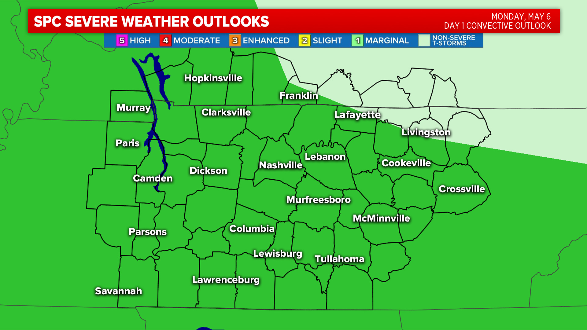
Monday afternoon will feature off-and-on scattered showers and storms. A marginal risk (level 1/5) has been re-issued for this afternoon and early evening. Main concern will come from heavy rain, but an hail, gusty winds & an isolated tornado cannot be ruled out.
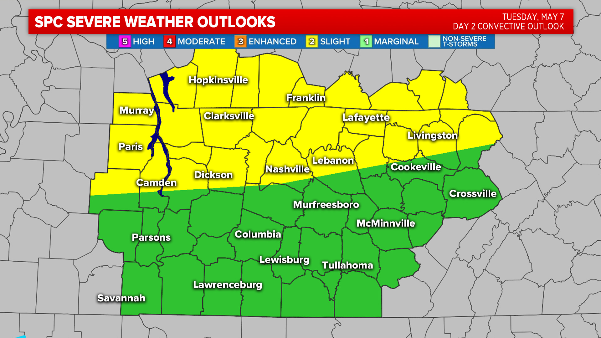
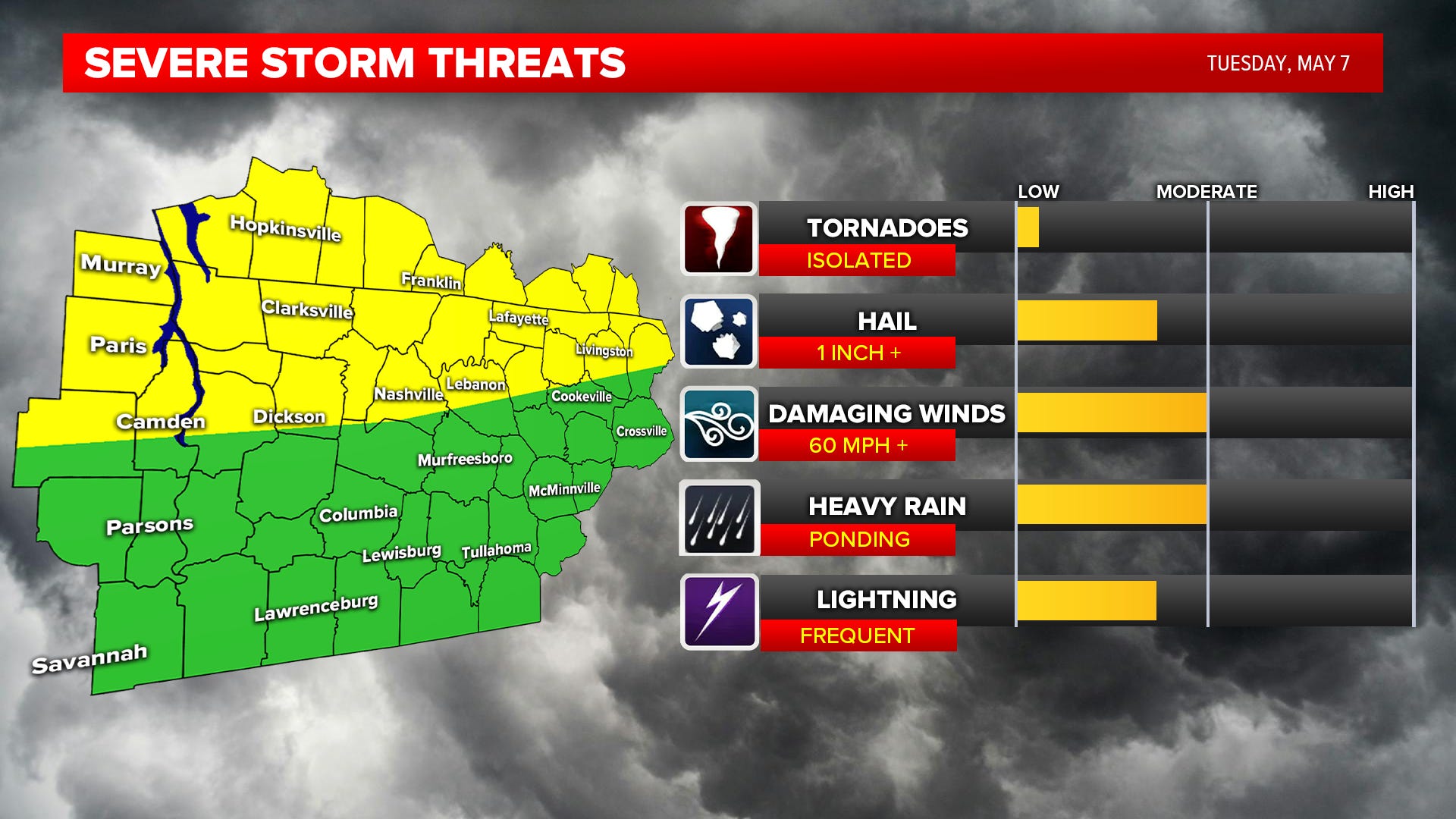
Strong storms are possible Tuesday and Wednesday. The risk for storms will come in waves. Tuesday afternoon will be the first round of storms during mid-afternoon and early evening.
Stay tuned to our FACEBOOK page for the latest updates!
**** Watch: Step by step instructions to program your NOAA Weather Radio. ****
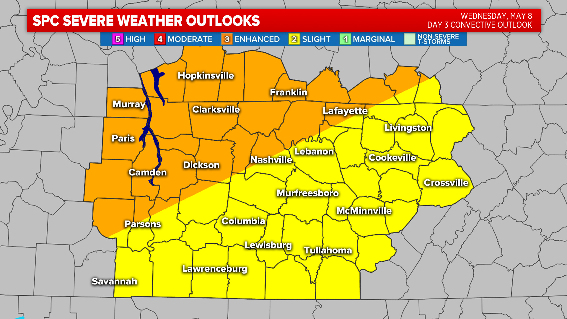
Secondary round occurs early Wednesday morning with a few lingering storms from overnight Tuesday. The day Wednesday will be mainly dry, partly sunny & warm. Highs will be in the mid to upper 80s. That will add “fuel to the fire” with the third round of storms expected late Wednesday night into Thursday morning.
After midnight, it could become a heavy rain event, so flash flooding could be possible. Storms are out of the area by 8am Thursday and we will gradually clear and cool.
Primary severe risk for Wednesday night into Thursday will be damaging wind gusts & heavy rain, but hail and isolated tornadoes are possible too.
Cooler weather moves in Friday with a cold front keeping highs in the upper 60s.
Weather Saturday will be great for Steeplechase! Mid 70s with a good mix of sun & clouds.
Mother’s Day, Sunday, we will remain mild in the mid 70s.
